The difference between data and information is that data has no context. With images captured you have data, but by stitching them together and providing the telemetry we can give them context.
The result is layers of useful information:
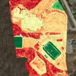
| * | A refractive map of the ground below could indicate surface condition. |
| * | An accurately captured up to date map of a large area to assist with measurement of construction or landscaping site. |
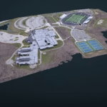
| * | A 3D model of the site including structures and materials. |
This intelligence has all sorts of potential.
Could it help you?